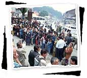
Day 1 : Srinagar to Kargil
Drass :

Drass 3230 metres, 60kms west of Kargil on the road to Srinagar, are a small
township lying in the centre of a valley of the same name. It has become
famous as the second coldest inhabited place in the world by virtue of the
intense cold that descends upon the valley along with repeated snowfall
during winter. Winter temperature is sometimes known to plummet to less than
40 degree Celsius. During the spring and summer, however the valley around
the township becomes very picturesque as the gently undulating hillsides
turn into lush green pastures splashed with a variety of fragrant wild
flowers. Its inhabitants are mainly of Darad stock, an Aryan race believed
to have originally migrated to the high valleys of the Western Himalayas
from the Central Asian steppes.
They speak Shina which, unlike the Tibetan-originated Ladakhi dialects
spoken elsewhere in Ladakh region, belong to the Indo-European linguistic
family. Their ancestral sport, Horse Polo, which the Darads play with
particular zeal, resembles our modern polo. The Drass vallley starts from
the base of the Zojila pass, the Himalayan gateway to Ladakh. For centuries
its inhabitants are known to have negotiated this formidable pass even
during the most risky period in the autumn or early spring, when the whole
sector remains snowbound and is subject to frequent snow storms, to
transport trader's merchandise across and the to help stranded travelers to
traverse it. By virtue of their mastery over the pass they had established a
monopoly over the carrying trade during the heydays of the Pan-Asian. A
hardy people enduring with fortitude the harshness of the valley's winter,
the inhabitants of Drass can well be described as the guardians of Ladakh's
gateway.
Day 2 : Kargil to Lamayuru
The caravan move toward the Kargil and the way passing through the: Kargil
:
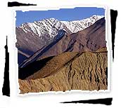
the valleys of Suru, Drass Wakha and Bodkarbo lie midway between the alpine
valleys of Kashmir, and the fertile reaches of the Indus valley and Ladakh.
The region is politically part of India, ethnically part of Baltistan and
geographically and integral part of Ladakh. Geographically, there is little
doubt that one has crossed the Himalayan watershed. The steep barren hills
now stretch to the snow line. As the snows melt, the waters flow freely down
into the heavily irrigated valleys. Here Tibetan-style settlements thrive.
Whitewashed mud and stone houses contrast with deep-green barley fields.
Shergol :
Between Kargil and Shergol you cross the dividing line between the Muslim
and Buddhist areas. The small village of Shergol has a tiny gompa perched
halfway up the eastern slope of the mountain. In the afternoon tourists will
reach to Kargil.
Mulbekh :
There are two gompas on the hillside above the village of Mulbekh. As in
other villages, it is wise to Enquire if the gompa is before making the
ascent. Just beyond Mulbekh is a huge Chamba statue, an image of a future
Buddha, cutting to the rock face beside the road. It's one of the most
interesting stops along the road to Kargil.
 Day
3 : Local Sight Seeing, Lamayuru, Likir and Alchi & in the evening hotel
at Leh
Day
3 : Local Sight Seeing, Lamayuru, Likir and Alchi & in the evening hotel
at Leh
Whole day is dedicated for the local sight seeing,
Lamayuru :
After exploring villages around the area, it comes as a surprise to find
that Lamayuru is a scruffy little place. The gompa, is the completely
overshadowed and most famous spectacular monastery in Ladakh.
Alchi and Likir Monasteries :
These two monasteries are located near Saspol on the Srinagar-Leh road.
They house many gigantic clay statue of Buddha in various forms. The primary
attraction of these monasteries is , however, their 1000-year old wall
painting which make a visit more than worthwhile.
Day 4 : Rest at Leh
Day 5 : Shopping and Cultural programme in the evening (Ladakhi Dance,
Depending upon the strength of group)
The whole day is dedicated to the shopping and to discover some interesting
things about Ladakhi art and cultural by the visiting the Tibetan refugees
camp Choklamsar, Library and Ecological Development etc.
Day 6 : Leh to Pangong Lake/ Tso Moriri Lake 9 hours, On way sight
seeing of Hemis monastery
Hemis Monastery :
This is biggest and the most important monastery in Ladakh. It is situated
49 kms to south of Leh, a little off the main Leh-Manali road. It was built
in the 17th century by Chapgon Gyalshas and ever since has enjoyed the
patronage of the royal family. Hemis is the headquater of the Drukpa order
and all the monasteries throughout Ladakh are administered by it.
Shey Palace and Monastery :
Also on the way to Hemis Gompa and 15 kms from Leh is the summer palace of
the erstwhile, Raja of Leh, set upon a hill sitting Buddha wrought with
copper and gold that leaves one lama before hand. Many chortens can be seen
to the east of the monastery. After the Shey tourists reach to Leh, Main
Centre of Ladakh. With the inhabitants of 50,000, Leh is located in small
valley just the north of Indus valley.
 Day 7 : Around lake of Tsomoriri lake/ Pangong lake Pangong Lake/ Tso
Moriri Lake
Day 7 : Around lake of Tsomoriri lake/ Pangong lake Pangong Lake/ Tso
Moriri Lake
Tso Moriri lake is situated in the middle of the elevated district of
Rupso. It name is characteristic of its situation. Nestle in the midst of
20,000 feet, peals which completely shut the lake. A kilometres ahead is a
picturesque village of Korzok consisting of about a hundred families.
Visiting the monastery on the top of the village, belonging to the yellow
sect and has about 35 resident monks. The night camp along the side of Lake.
The main attraction Changla region is the Pangong Lake situated at 14,500
feet (4,297 m) a long narrow basin of inland drainage, hardly six to seven
kilometres at its widest point and over 130 kms long, it is bisected by
international border between Indian and China. The farthest point to which
foreigners are permitted, is only some seven kilometres along the southern
shore from the head of the lake. Another attraction of this lake is sight os
eastern cranes and other migratory black necked cranes birds.
Day 8 : Tsomoriri lake/ Pangong lake, to Keylong
The tough journey will begin toward Manali. On the descent tourists are
leaving the Ladakh region and the last village is the Upshi and one can
enjoy the beautiful landscape and magnificent valley views. The next pass is
Taglang La, the second highest motorable road of the world, 5328 metres. The
next destination is the Pang. Just after this pass tourist are entered to
the tent site called Sarchu. Lachlung La, 5060 metres, is the second highest
pass on the Leh-Manali road. While next move is the , which is 4883 metres
means crossroads pass Baralachala. The journey becomes more adventurous and
interesting while passing the this pass. Darcha is the another major tent
site on this road.
Day 9 : Keylong to Manali
The journey will begin toward Manali in the morning, Rohtang Pass 3978
metres not high, but treacherous all the same-starts the ascent to Manali.
Keylong is the last town of any size on the journey to Manali.


